Four views of I-90 in one frame, and nine more state DOT cameras
The camera at the I-90 rest area outside Ashtabula sends four pictures at once. East down the interstate, west back up it, and both ends of the ramp loop, stitched into one 2560 by 1920 frame with the time burnt across the top strip. At 09:23:35 local on 23 October 2026 half a dozen trucks were parked along the back of the lot and the trees behind them had gone orange, and the whole thing arrived as one 190 kB file. It is the most picture any American state transport department hands a passer-by, and I only know that because I pulled a live frame from ten of them this morning and measured what came back.
Everything below was fetched between 13:16 and 13:25 UTC on 2026-10-23, one camera per state. Frame size comes out of the JPEG header. Age comes from the Last-Modified the camera's own server sent, sampled three or four times so the gap between frames is measured rather than taken on trust. For the four states that publish video I read the picture size and the segment length out of the playlist instead. Texas is not here: it has more live cameras than any other state on the site, 4,727 this morning, but its camera pages serve their frames through the site's own fetcher rather than a public image URL I could time from here, so there was nothing to measure.
The six that send a still
- Ohio, I-90 at the Ashtabula rest area. Four views in one file, and the file was replaced four times between 13:21:56 and 13:24:06 UTC, which is a new frame about every 43 seconds. ODOT burns the camera name, the compass direction of each pane and the local clock into the top of the image, so a frame you saved last week is still evidence this week.
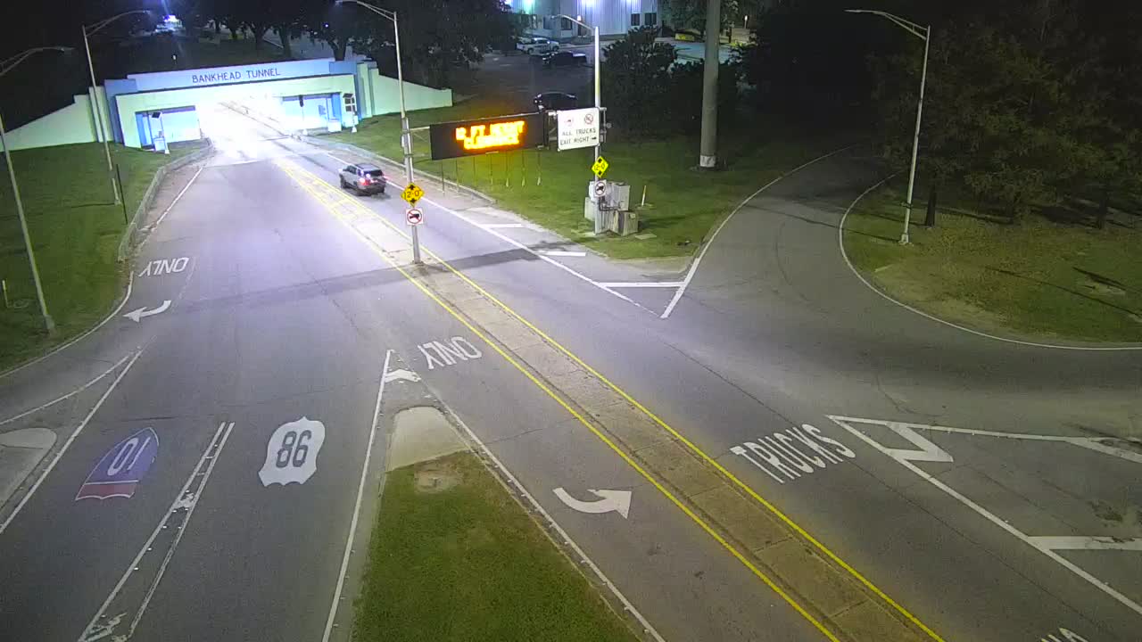
- Alabama, the east portal of the Bankhead Tunnel in Mobile. 1280 by 720, and at 08:16 local the sun was low enough to throw lamp-post shadows the whole width of US 90/98, with the tiled portal white and blue under the trees. The snapshot I took at 13:22 UTC was stamped 13:16:54 and asks to be cached for ten minutes, so this one is a look rather than a watch.
- Wyoming, WYO 22 on the west side of Teton Pass. Also 1280 by 720, and at 07:24 local it was still in night mode: the carriageway a pale band under one lamp, old snow in the gravel on the left, the timber above the cut a solid black mass. Old snow in the gravel on the 23rd of October is the whole reason to keep this one bookmarked.
- Michigan, I-75 at Caniff Street in Detroit. 320 by 240, among the smaller pictures here, and the freshest of the lot: the file carries a Last-Modified equal to the second you ask for it, and two frames I took 93 seconds apart were different pictures of different traffic.
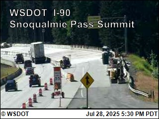
- Washington, I-90 at the Snoqualmie Pass summit. 320 by 239, fewer pixels than anything else in this list. The frame stamped 13:21:43 UTC was still the newest one at 13:24:20 and had been replaced by 13:24:51, so about three minutes between pictures. At 06:21 Pacific the summit was dark, with headlights flaring off a wet surface and the WSDOT label sitting in the corner.
- Oregon, US 20 at Santiam Pass. A 328 by 314 square, barely bigger, and the one I would keep if I could keep only one, because ODOT prints a band under the picture: elevation 4,766 feet, milepost 80.14, temperature 29.3F, wind south-west at 13 mph, updated 6:20 AM. Three stamps on that image across six minutes came 101 and 77 seconds apart.


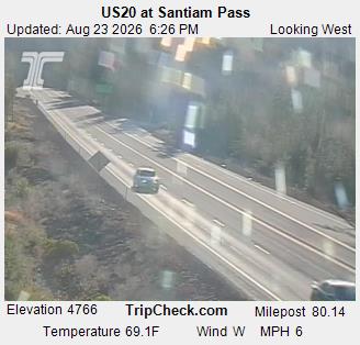
Below freezing on the pass at dawn is exactly when a 328-pixel picture with a thermometer in it beats a sharp one without.
The four that send video
Maryland, South Carolina, Colorado and Virginia publish HLS, so what you get is motion: a van actually crossing the bridge rather than a van that has jumped half a span since you last looked. The cost is resolution. Ohio's one still carries sixteen times the pixels of Maryland's video frame, and Maryland's is the sharpest video of the four.
- Maryland, US 50 east of the Severn River at Annapolis, 640 by 480 in five-second segments. This is the road to the Bay Bridge, so on an October Friday afternoon it is the camera that tells you whether the eastbound queue has started.
- South Carolina, US 17 southbound on the Arthur Ravenel Jr Bridge, 480 by 270 in segments of 4.07 seconds. Cable stays, the harbour behind, container ships moving under it.
- Colorado, I-70 a third of a mile east of the Eisenhower Tunnel, 352 by 240 in segments of 4.13 seconds, on the eastern approach to the tunnel under the Continental Divide. Open it during a storm and you can watch the spray come off the trucks on the climb.
- Virginia, I-64 at mile marker 99.3, 320 by 240 in segments between 5.5 and 7.3 seconds. The camera page puts it at 38.0342, -78.8694, which puts it on the Afton Mountain climb just west of Rockfish Gap. I would open that one on a damp morning rather than a clear one.
Reading the counts next to the pictures
A state's camera count and its picture quality turn out to have nothing to do with each other. Virginia has 1,960 live cameras on the site this morning and the softest video of the four. Maryland has 715 and the sharpest. Ohio, with 1,201, quietly publishes a frame with almost five million pixels in it, and you only see them if you open the image on its own.
We are going to run the same measurement on the same ten cameras on 2026-11-21 and publish the second column next to this one, because a refresh figure with one reading behind it is a snapshot and two readings make a trend. The winter cameras are the interesting ones there: Santiam, Snoqualmie, Teton Pass and the Eisenhower approach all get busier and slower when the weather arrives.
One thing I still want and cannot find. DriveBC publishes update_period_mean for every camera in its public list, a measured average of how long a frame actually takes to arrive, and it is the single most useful field I have seen in any camera index. No US state DOT I have read publishes anything like it. If one does and I have missed it, I would like to know which, because measuring ten cameras by hand is fine and measuring ten thousand is not.