Seven highway cameras on the roads into Valemount
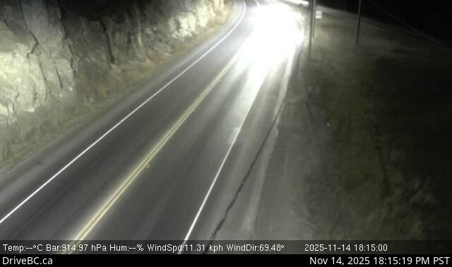
At 06:00 PDT on 2026-10-03 the Tete Jaune Cache camera was the only lit thing on Highway 16 for twenty kilometres. Streetlights down the curve, a rock cut on the left, a blue rest area sign in the gravel, one set of headlights coming over the rise, and the frame stamped 06:00:04. That camera stands at the fork where Highway 5 meets Highway 16, 19.5 km north-northwest of Valemount, so it is the one to look at if you are coming up the valley and still choosing between Jasper and McBride. It is also lit, which almost nothing else in this corridor is, and that makes it the only camera here worth opening before dawn.
Six more sit on the same two highways within 101 km of the village. All seven are DriveBC's, and their public webcam list held 1,066 cameras when I pulled it at 13:05 UTC on 2026-10-03. For each camera it publishes the caption, the coordinates, the elevation and update_period_mean, which is DriveBC's own measurement of how long a frame actually takes to arrive rather than the interval someone intended. That last field is the useful one and I have not seen another directory show it.
The seven on Highways 5 and 16
Distances below are straight lines from the centre of the village at 52.8286, -119.2639, worked out from the coordinates DriveBC publishes for each camera. The road is always longer.
- Tete Jaune Cache, 19.5 km, at the junction itself, looking east. The decision point for the whole corridor, lit all night, and at 783 m low enough that it tells you about rain rather than snow. Its frame landed at 06:00:04 on 2026-10-03 on a measured period of 899 seconds.
- Red Pass, 24.2 km northeast at 1,045 m, east along Highway 16 towards Mount Robson. Spruce on both sides, wet asphalt most of the autumn, no shoulder to speak of. 728 seconds, and of the seven it is the one whose timing wanders most in the useful direction: a standard deviation of 40 seconds means frames sometimes arrive early.
- BC-Alberta Border, 54.1 km east, the fastest in the corridor at 299 seconds. It sits at 1,133 m on the climb to Yellowhead Pass, which is where this road first turns into winter, and five minutes between frames is quick enough to watch weather move through. DriveBC notes it runs on satellite, so a delay there is the link, not the camera.
- Dunster Station Road, 52.0 km northwest on Highway 16 towards McBride, at 771 m, looking east down the Robson valley. 900 seconds. This is the one to check for valley fog, which forms down there on clear October nights and burns off by mid-morning.
- Lempriere, 49.6 km south, on the long empty stretch between Albreda and Blue River where there is nothing else to look at for forty minutes of driving. Solar-powered, 900 seconds.
- Blue River, 80.1 km south at Shell Road, looking northeast into town. Best of the set for weather rather than road, because the cloud base sits on the ridge behind and you can see exactly where it stops. At 06:00 on 2026-10-03 there were trucks parked up on the left under the one streetlight and a lit sign at the far end of town. 900 seconds.
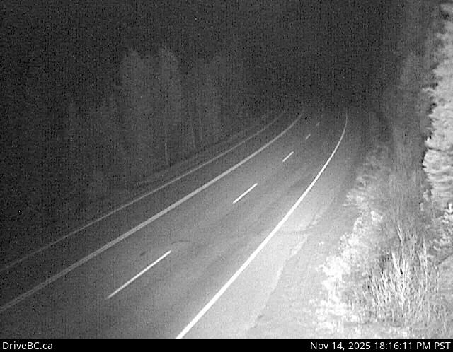
- Messiter Summit, 100.5 km south, and the slowest at 1,794 seconds, which is half an hour between frames. Useless for traffic, good for one thing: this is where the snow line first shows up on the drive north from Kamloops, and the camera runs in infrared overnight, so at 05:47 on 2026-10-03 the roadside brush came out white and the trees came out as pale shapes in the dark.
A refresh rate you can check
The period numbers above are measurements, not settings, and that is why they are worth reading. Four of the seven report a standard deviation of zero: Dunster, Lempriere, Blue River and the border camera land on their interval every time. Tete Jaune Cache reports one second. Red Pass reports 40. Messiter Summit reports 56, which on a camera DriveBC itself flags as solar-powered is the honest version of "about every half hour".
Because it is a mean over recent arrivals rather than a configured interval, the figure moves on its own. Red Pass reads 728 seconds today; a fortnight of early frames would pull it under 700 without anything changing at the roadside. So any refresh figure, ours or anyone's, is worth reading with the date attached. Every figure above came off the list at 13:05 UTC on 2026-10-03. I will come back to this corridor at the end of October and report what the first cold week does to the timing on the three remote cameras.
The three cameras in the village itself
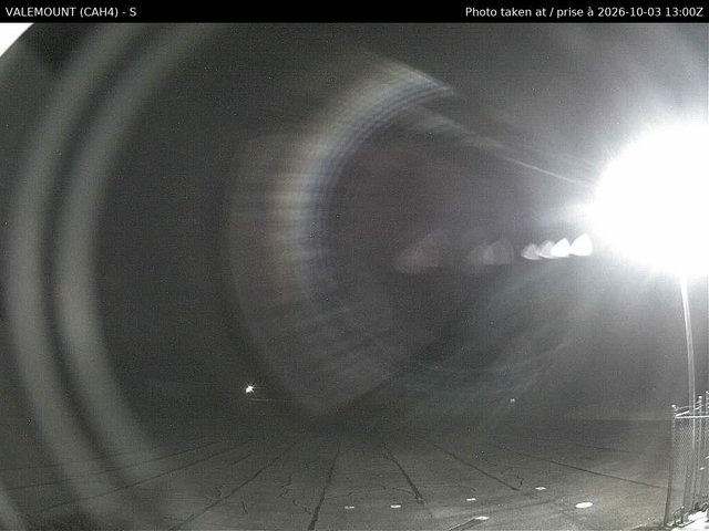
Valemount (S) and Valemount (NW) are aviation cameras at the airport, 5 km from the village, and they are better than they sound. They shoot the sky on purpose. The southern one answered with a frame captioned VALEMOUNT (CAH4) - S and stamped 2026-10-03 13:00Z when I fetched it at 13:06 UTC, four minutes behind real time on a ten-minute cadence, the apron light flaring across the lens and the cloud sitting well down on the ridge. Every frame carries its own timestamp in UTC, burnt into the image, which means you never have to trust anyone's metadata to know how old the picture is. If you want to know whether it is raining in Valemount right now, this is the camera. If you want to see the town, it is not.
CMH Cariboos - Cariboo Lodge is 29 km southwest at a heli-ski lodge and is the prettiest frame of the lot when it is running: lawn, deck rail, spruce, a glacier on the skyline. It is between seasons at the moment, the file having last been rewritten at 12:18 GMT on 2026-09-25, so it is one to come back to when the snow does. For the view most people actually picture when they type the village name, the Highway 5 and 5th Avenue intersection with the Rockies behind it, the Village of Valemount runs its own camera on its own site.

Matching a camera to a road
DriveBC files these seven under Thompson-Nicola, Fraser-Fort George, Tete Jaune Cache and Blue River, because that is what the upstream record calls those places, and none of those four is the name a person types. Grouping them by the road instead is what the list above does, and for one corridor, done by hand, that is fine.
Where it gets hard is the edge. Messiter Summit is 100.5 km from Valemount and genuinely useful to anyone driving up from Kamloops. The Mica Dam pair is 96.3 km away and useful to nobody making that trip, because it sits on Highway 23 up a different valley entirely. Distance alone gets that backwards. A road network would get it right and we do not have a road network. If you know a public dataset that would let a camera say which route it belongs to, I would like to hear about it.