opencctv.org

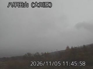
Hakkoda Mountains, Okawara Trail

Live

Kuroishi, Aomori, Japan

Local conditions - - - -
Hakkoda Mountains, Okawara Trail Hakkoda Mountains, Okawara Trail
Connecting...
View full screen
Location
Category
Coordinates
40.6437, 140.8058
Feed Type
IMAGE
Camera ID
121374

Live volcano webcam at Hakkoda Mountains, Okawara Trail in Kuroishi, Aomori, JP. Watch real-time conditions at Hakkoda Mountains, Okawara Trail. Explore more volcano cameras from around the world on opencctv.org.

Hakkoda Mountains, Okawara Trail is a volcano camera in Kuroishi, Aomori, JP, positioned at 40.6437°, 140.8058°. It looks out over the volcano and surrounding terrain. It is one of 2 live cameras in Kuroishi.

Loading weather…
Recent uptime
100% over last 9 checks, latest 4 Nov 2026
More cameras in Kuroishi More Nature cameras Random camera

Similar cameras

Atosanupuri Volcano, Northeast Slope
Teshikaga, Hokkaido
Atosanupuri Sulfur Mountain Parking
Teshikaga, Hokkaido
Atosanupuri, Lake Kussharo South
Teshikaga, Hokkaido
Meakan Volcano, Upper Totsutsubessu
Kushiro, Hokkaido
Daisetsu Mountain, Chuubetsu Lake East
Biei, Hokkaido
Daisetsu Mountain, Asahidake Summit View
Higashikawa, Hokkaido

Frequently asked questions about Hakkoda Mountains, Okawara Trail

Is this camera live now? +
Yes — the feed is fetched directly from the public source in real time. If the camera is offline, the page will indicate this.
Can I watch this camera on my phone? +
Yes — every camera on opencctv.org works on mobile browsers. Open the page on your phone and the live feed will play directly.
Why is the camera offline? +
Cameras occasionally go offline for maintenance, weather, or network issues. The page will indicate the camera is offline and we re-check the feed automatically.

Nearby Cameras

National Route 394 Aomori
🚗 1.3 mi away
Hakkoda Mountains, Hell Marsh
🌋 2.5 mi away
荒川 › East
荒川 › East
⛷️ 2.5 mi away
Teiikawa River, Oyanagi
💧 6.4 mi away
Kurogane River, Upstream Left Bank
💧 6.7 mi away
Kurogane River, Downstream Left Bank
💧 6.7 mi away
Dam Building, Kurogishi
💧 6.7 mi away
Hirakawa Administrative Building Right Bank
💧 6.7 mi away