opencctv.org

Vanderhoof › West: Vanderhoof Airport (CAU4)

Live

Vanderhoof, British Columbia, Canada

Local conditions - - - -
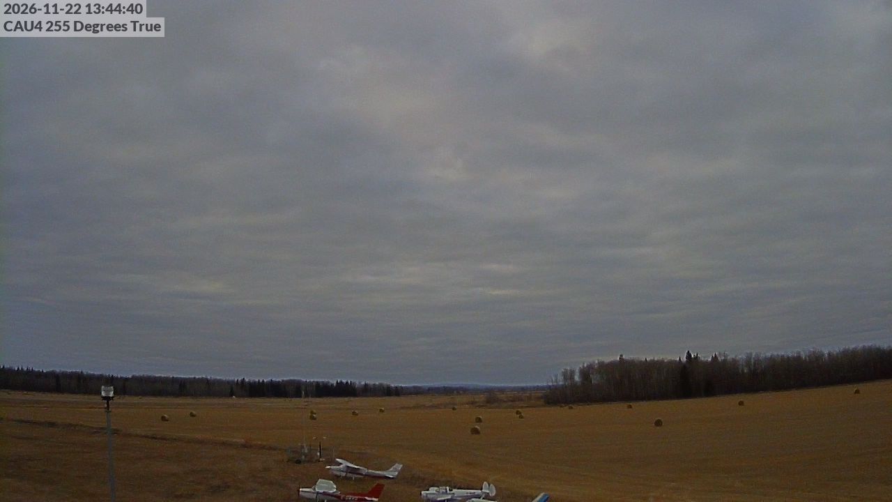
Vanderhoof › West: Vanderhoof Airport (CAU4) Vanderhoof › West: Vanderhoof Airport (CAU4)
Connecting...
View full screen Open feed URL
Location
Category
Coordinates
54.0509, -124.0117
Feed Type
IMAGE
Camera ID
424849

Camera operated by a third party. Not affiliated with or endorsed by OpenCCTV.

Live weather webcam at Vanderhoof › West: Vanderhoof Airport (CAU4) in Vanderhoof, British Columbia, CA. Watch real-time conditions at Vanderhoof › West: Vanderhoof Airport (CAU4). Explore more weather cameras from around the world on opencctv.org.

Vanderhoof › West: Vanderhoof Airport (CAU4) is a weather camera in Vanderhoof, British Columbia, CA, positioned at 54.0509°, -124.0117°. It looks out over current sky and weather conditions. It is one of 6 live cameras in Vanderhoof.

Loading weather…
Recent uptime
100% over last 10 checks, latest 21 Nov 2026
More cameras in Vanderhoof More Weather cameras Random camera

Similar cameras

Rovaniemi: Lordin Aukio, Finland
Rovaniemi, Mainland Finland
Klíny Ski Area
Klíny Ski Area
Kliny, Ustecky kraj
Cape Town: South Africa
Cape Town, Western Cape
Oslo: Havn - Raadhuskaia
Oslo, Oslo
Parga, Epirus
Parga, Epirus
Agia Kyriaki, Epirus and Western Macedonia
Honolulu: Beach
Honolulu: Beach
Honolulu, Hawaii

Nearby Cameras

Vanderhoof Airport (#1)
✈️ 498 ft away
Vanderhoof Airport (#2)
✈️ 498 ft away
Vanderhoof Airport (#3)
✈️ 498 ft away
Vanderhoof › East
Vanderhoof › East
✈️ 0.2 mi away
Vanderhoof › East: Vanderhoof Airport (CAU4)
✈️ 0.4 mi away
Hwy 16 at Hwy 27 - N
🚗 5.1 mi away
Hwy 16 at Hwy 27 - W
🚗 5.1 mi away
Hwy 16 at Hwy 27 - E
🚗 5.1 mi away